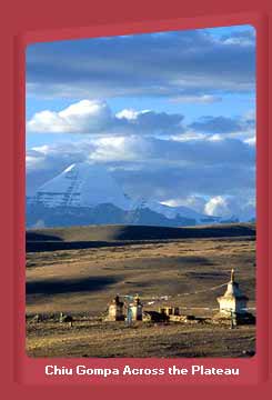
Geography and Natural History
In geological terms, the creation of the himalayas and the rising of the Tibetan plateau are extremely recent events. The mountains originated less than four million years ago, making them among the youngest in the world.There are three distinct geographical regions in greater Tibet.
By far the largest natural region is the Northern Plateau, or Chang Tang, which covers about half of Tibet's total surface area and is delineated in the west by the great Karakoram range, in the north by the wall of the Astin Tagh, and in the northeast by the Nan Shan range.
The chang tang has one of the worst climates on earth and therefore most of the part of this region is never visited by humans.
The second main geographical region of Tibet, the outer plateau is a relatively narrow strip, with the Himalayas forming the southern boundary. It is the most populous part of Tibet and contains almost all the major human settlements.
The outer plateau differs from the northern plateau in several important ways. The temperature and climate are milder, and consequently there is a richer distribution of flora and fauna. The area around shigatse and the Lhasa valley are clear examples of this. Contrary to popular images of Tibet, Lhasa has a pleasant climate, with nearly all its rainfall occurring in the summer. For most of the year the weather is sunny and dry, mild during the day from April to October, and not unbearably cold in winter.
The other main geographical region is the southeastern plateau, comprising only one-tenth of the total area of Tibet and forests are very much a characteristic of this region.


